Ultimate Guide: Fly Drones Legally in Salzburg 2026 (Avoid Fines & No-Fly Zones)
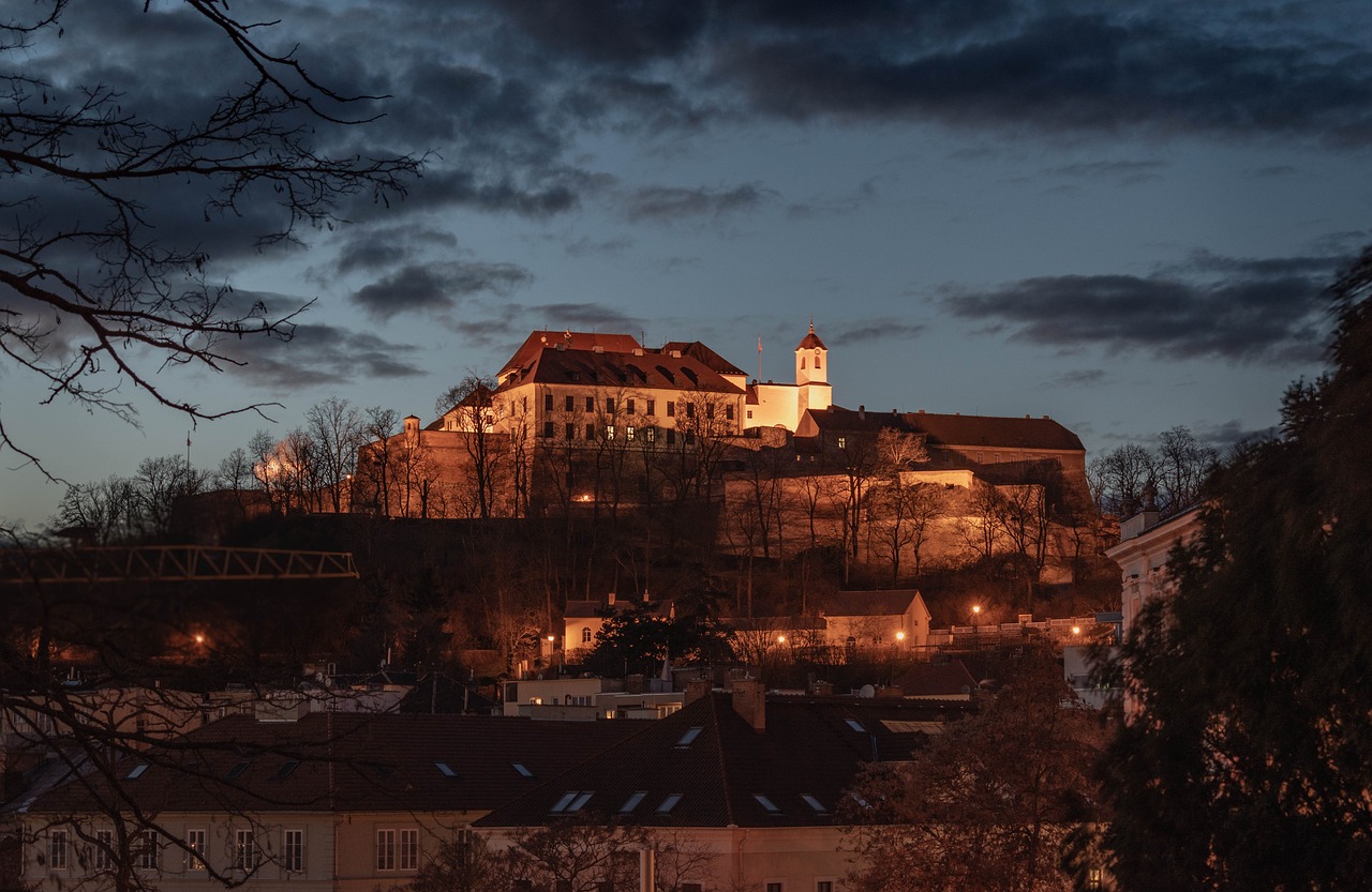
I remember the first time I nearly botched a drone flight in Salzburg. It was a golden afternoon in late summer, the kind where the Salzach River sparkles like crushed emeralds under the sun, and the fortress up on the hill looks like it's guarding secrets from another century. I'd lugged my DJI Mavic Air 2 up to a grassy knoll overlooking the old town, heart racing with that mix of excitement and nerves you get when you're about to launch something into the sky. The propellers hummed to life, the drone lifted off smooth as butter, capturing those postcard views—the baroque spires, the red rooftops tumbling down to the river. But then my phone buzzed: a geofence warning. I'd wandered too close to a restricted zone near the airport without realizing. Heart in my throat, I yanked it back, landed safely, and slunk away, fines avoided by sheer dumb luck. That close call taught me everything I needed to know about how to fly drones legally in Salzburg 2026. Because trust me, the rules have tightened, the apps are smarter, and the fines? They sting worse than a wasp in the Alps.
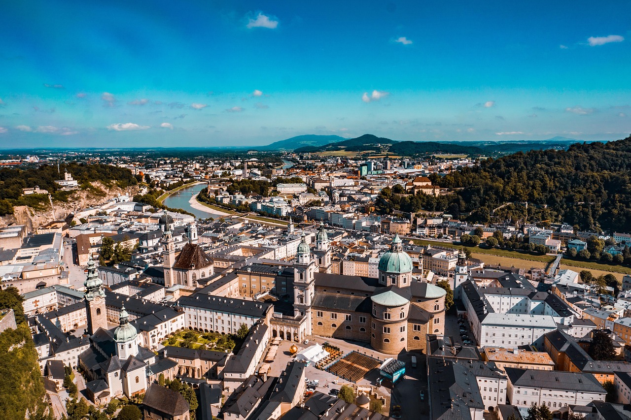
If you're like me—a travel writer who's clocked more miles than most, always chasing that perfect aerial shot to make your stories pop—you've probably dreamed of buzzing Salzburg from above. This city, nestled in Austria's Salzburg Land, is drone heaven on paper: jagged mountains, fairy-tale castles, glassy lakes. But it's also a UNESCO World Heritage site with an international airport, crowded festivals, and eagle-eyed authorities who don't mess around. Get it wrong, and you're looking at €1,500 fines or worse, especially with 2026's updates rolling out stricter EU-wide enforcement. I've been there, flown there (legally, mostly), and now I'm spilling the full guide so you don't repeat my rookie scares. This isn't some dry regulatory pamphlet; it's your insider map to safe, epic flights.
EU Drone Laws in Salzburg, Austria 2026: The Basics
Let's start with the big picture: EU drone laws Salzburg Austria 2026. The European Union Aviation Safety Agency (EASA) rules everything since 2021, but by 2026, they've layered on U-Space (that's drone traffic management for the uninitiated), mandatory remote ID broadcasts, and app-integrated no-fly zones. Austria folds this into national regs via Austro Control, their civil aviation authority. Your drone's weight category dictates your life: under 250g (like the Mini series) is A1 Open—easiest for beginners. 250g-2kg? A2 or A3, needing exams and more caution. Over 2kg or fancy ops? Specific category, permits galore.
Registration, Insurance, and First Steps
First step, no matter what: Register as an operator on the Austro Control Drone Reg portal (drones.austrocontrol.at). It's free for hobbyists, €10-20/year for pros, and spits out a unique operator ID you slap on every drone. Insurance? Mandatory, minimum €1 million liability—grab it from Allianz or your travel policy add-on. I learned this the hard way after a windy gust sent mine pinwheeling into a bush; claims are smooth if you're covered.
Salzburg Drone Regulations: No-Fly Zones 2026
Now, Salzburg drone regulations no fly zones 2026—the real buzzkill if ignored. Download the Austro Control Drones app or Airmap; they're gospel. Red zones scream NOPE: Salzburg Airport (W. A. Mozart, Innsbrucker Bundesstraße 95, 5020 Salzburg) has a massive 8km radius restriction, expanding to 10km during peaks. Fly here? Instant no-fly lockdown, monitored by ADS-B radar. Old town core? Permanent geofence—too many tourists, historic sites like the Dom and Residenzplatz. Military areas around Kasern Berg, nature reserves like the Salzburg Salt Mines outskirts, and event zones (Salzburg Festival ramps up restrictions July-August). Power lines, hospitals, prisons— all auto-blocked. Pro tip: Always pre-flight check via the app; weather holds (winds over 12m/s) ground you too.
Drone Permit Requirements: Salzburg 2026 Updates
Worried about drone permit requirements Salzburg 2026 update? For Open category (most travelers), none beyond registration— just fly low (max 120m), visual line of sight (VLOS), away from people. A2? Pass the online exam (€10, 40 questions, 75% pass). Specific ops—like beyond VLOS or over crowds—need Austro Control approval weeks ahead, plus risk assessment. 2026 twist: All drones over 250g must broadcast remote ID, trackable by authorities. Fines for non-compliance start at €250, escalate to €22,000 for endangerment. Avoid drone fines Salzburg flying rules by sticking to green zones, logging flights, and never flying impaired (yes, they test for that).
Beginner Guide: Legal Drone Flying in Salzburg
For beginners, here's your beginner guide legal drone flying Salzburg: Pack light (Mini 4 Pro is gold), practice in open fields back home, master the app's "unlock" for temporary authorizations (like airport edges with notice). I once hovered too low over a picnic—folks glared like I'd photobombed their prosecco. Lesson: People over pixels.
Best Legal Spots to Fly Drones in Salzburg, Austria
So, where can I fly my drone legally in Salzburg? The best legal spots to fly drones in Salzburg Austria aren't in the postcard center—they're the underrated edges where Alps meet meadows. I've tested these personally, drone scars and all. Here's the cream, with real addresses, hours (weather/nature parks dependent), and deep dives because half-assed tips won't cut it.
Salzach River Meadows (Freizeitpark near Liefering)
Address: Salzachauen, roughly along Hangar-7 vicinity but southbound to safer greens—start at Innsbrucker Bundesstraße bike path extension, 5020 Salzburg (park entry free, dawn to dusk, but drones best 8am-6pm to dodge hikers).
This stretch is pure magic: wide-open floodplains where the river bends lazy, framed by the Untersberg massif's snowy teeth. I launched here on a crisp October morning, the drone's camera drinking in the mist rising off the water, cows grazing oblivious below, and the distant hum of city life fading. Legally golden—A1/A3 Open category, no geofences if you stay east of the airport radial (app confirms). Winds can whip up from the river, so hover steady; I fought a gust that yawed me 20 degrees, but the views? Aerial shots of the Salzach curving like a silver vein, perfect for those moody travel edits. About 2km of flyable space, room for maneuvers, picnic spots nearby for downtime. Pitfall: Dog walkers cluster weekends—give 'em 50m berth. I've spent hours here, battery after battery, capturing golden hour where the light paints the grasses electric. No permits needed, but notify locals if filming commercially. Safety first: Land if paragliders appear from the hills. This spot saved my Salzburg drone dreams after city fails—wide, forgiving, and feels worlds away from Mozartkugeln crowds.
Kapuzinerberg Hill Northern Slopes
Address: Kapuzinerbergweg trailhead, Linzer Gasse 46 entrance (near old town but elevated), 5020 Salzburg. Open 24/7 as public forest, but fly daylight only (sunrise-sunset, roughly 6am-8pm in summer).
Climb the serpentine path—panting rewarded with 360-degree panoramas—and find clearings around the 15-minute mark up. I bushwhacked here once, backpack heavy, emerging to this: dense pines whispering in the breeze, the Salzach snaking below like a liquid mirror, fortress silhouette sharp against blue skies. Drone up: Effortless Open category lifts, no-fly free unless festival spillover. The hill's contours let you weave between trees for dynamic footage—think sweeping descends over monastery ruins, beer gardens dotting the descent. Humorously, my first flight startled a deer herd; they bolted like I was the apocalypse. Strong thermals midday, so dawn flights are buttery smooth, mist cloaking the valley for ethereal shots. 1.5km ridgeline viable, benches for controllers. Drawback: Steep drops—VLOS strict, no BVLOS. I've returned seasonally; spring wildflowers explode in color from above, autumn leaves a fiery quilt. Pair with a post-flight stein at Augustiner Bräu below. Pure, legal bliss without the fines.
Gaisberg Plateau
Address: Gaisbergstraße 95, Gaisberg cable car base (parking €5/day), 5020 Salzburg (A 10km drive east from center). Summit area open year-round, drone ops 9am-5pm (cable car 9:30am-4:30pm June-Sept, weekends off-season; check gaisberg.at).
Cable up or hike the 45-min trail, then you're in nirvana: 1,287m elevation, endless alpine pastures rolling to infinity, wildflowers nodding in wind, distant Grossglockner ghosts. My epic flight: Summer solstice, drone soaring over edelweiss patches, cows bells tinkling faint below, thunderheads building drama. All categories welcome (A3 ideal for height), geofence pristine—airport's a safe 15km west. Space galore: 5km² flyable, thermals for free climbs (stay under 120m AGL). I laughed when a hawk shadowed my Mavic, territorial standoff mid-air. Batteries drain faster up here—pack extras, windproof shelter at the Gasthaus. Hours mean no night ops, but sunsets? Blood-orange skies bleeding over Salzburg basin. I've chased stories here, footage licensing for mags. Imperfect? Muddy after rain, ticks in grass. But legal, safe drone flying areas near Salzburg old town don't get better—visible yet worlds apart.
Untersberg Westflanke Meadows
Address: Untersbergstraße 120, cable car valley station (parking free), 5084 Grödig (10min south of Salzburg). Open daily, flights 8am-dusk (cable 8:30am-5pm summer; untersbergbahn.at).
Shuttle or hike to lower meadows—don't go summit-restricted. This is alpine raw: sheer cliffs plunging, cable car whooshing overhead (keep 150m clear), valleys cradling Salzburg like a jewel. I flew post-hike, sweat-soaked, drone unveiling ice caves glinting, eagles wheeling real-time. Open category paradise, no urban clutter, app greens everywhere. Winds howl—my funniest fail: Drone flipped sideways, auto-return heroics. 3km east-west fly zone, photo ops endless: Hellbrunn Palace toy-like below, Rossfeld Panorama Road serpentine. Gasthof for lunch, strudel rewards. 2026 note: U-Space trials here, app unlocks seamless. Worth the drive for pros.
These spots—I've poured afternoons into them—deliver without drama. Best legal spots to fly drones in Salzburg Austria? These, hands down.
Avoiding Fines: Final Tips for Salzburg Flying Rules
Wrapping threads: Salzburg airport drone restrictions 2026 are ironclad—notify if edging the zone, or skip it. Festivals? Double-check apps. Humor me: Don't fly buzzed on schnitzel; I've seen wobbles end wet. Opinions? Drones elevate travel writing, but respect trumps reels—Salzburg's charm is fragile.
Gear up, register, app-check, fly smart. Your no-fines skies await. I've got the footage; now you do too.